|
Hardware:
 MTS3000
basically consists of two elements: an MSI hi-tech
electronic circuit based on a PIC18FXX20 Microchip
microprocessor, and a set of circuits and Flash
memories which allow full control of several boat
functions, communication with GPS and ECO, and data
recording. The system can retain information for
up to one year: retainment time depends on sampling
time, which varies between 10 and 120 seconds. MTS3000
basically consists of two elements: an MSI hi-tech
electronic circuit based on a PIC18FXX20 Microchip
microprocessor, and a set of circuits and Flash
memories which allow full control of several boat
functions, communication with GPS and ECO, and data
recording. The system can retain information for
up to one year: retainment time depends on sampling
time, which varies between 10 and 120 seconds.
MTS3000 is preset for two engines: if installed
on a sailboat, it refers to the right (“main”) engine.
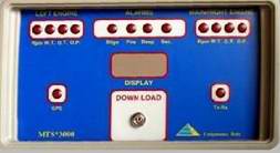
It is installed in a compact and waterproofed aluminium
box, whose dimensions are cm. 155x85x150.
On
the front panel are:
• Alarm leds
• A 2x8 characters display showing short message
information about the state of the system
•
A plug which allows the user to download the recorded
information to a PC
On
the back panel are:
•
A connector for external linking to different signals
• A button which allows data initialisation
Software:
MTS3000
is supplied together with a software for immediate
analysis of data recorded by the system and downloaded
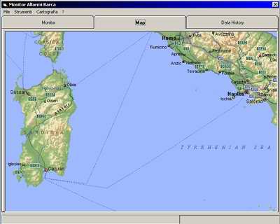
to PC through a serial port. Once data are transferred,
the software visualizes a summary chart showing
every event occurred during the recent navigation:
total duration, stops, alarms, total miles, and
so on. This way, actual distance covered by the
boat can be tracked on a nautical map, indicating
any relevant event through an icon.
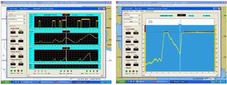
When more detailed information about engines or
sound line is needed, some graphic panels show value
variations through time. Graphic also show useful
information for maintenance and anomaly prevention.
Several intuitive and usable controls allow an accurate
analysis of boat history. The software can show
up to 99 boats and unlimited events.
Engine
|